
1. Morning Walk

    Figure 1. A map of San Francisco, California. The path of a two and a half mile (four and a quarter kilometer) walk is indicated. About 5200 steps and 157 feet (48 meters) elevation over three quarters of an hour.
  2. Morning Walk

    Figure 1. A map of San Francisco, California. The path of a one mile (one and three quarters kilometer) walk is indicated. About 2100 steps and 39 feet (12 meters) elevation over a quarter hour.
  3. gps dues not work in the bay view

    Figure 1. A map of San Francisco, California. The path of a two and a quarter mile (three and three quarters kilometer) walk is indicated. About 4600 steps and 85 feet (26 meters) elevation over one hour, (half an hour moving).
  4. The Inferno

    Dante Alighieri, Dante

    Cover of The Inferno by Dante Alighieri, Dante, published 2002-07-22 by Anchor, a 736-page paperback
    Figure 1. Cover of The Inferno by Dante Alighieri, Dante, published 2002-07-22 by Anchor, a 736-page paperback.

    Read along with Hubert Dreyfus’s “Philosophy 6” Berkeley lectures (archive.org/details/ucberkeley_webcast_itunesu_461120619) from 2007, which helped motivate me. Before I started, I wasn’t sure I would continue through and finish the comedy. Having read this Inferno, I’m pretty sure I will.
  5. Tfw you’ve been through hell AND purgatory

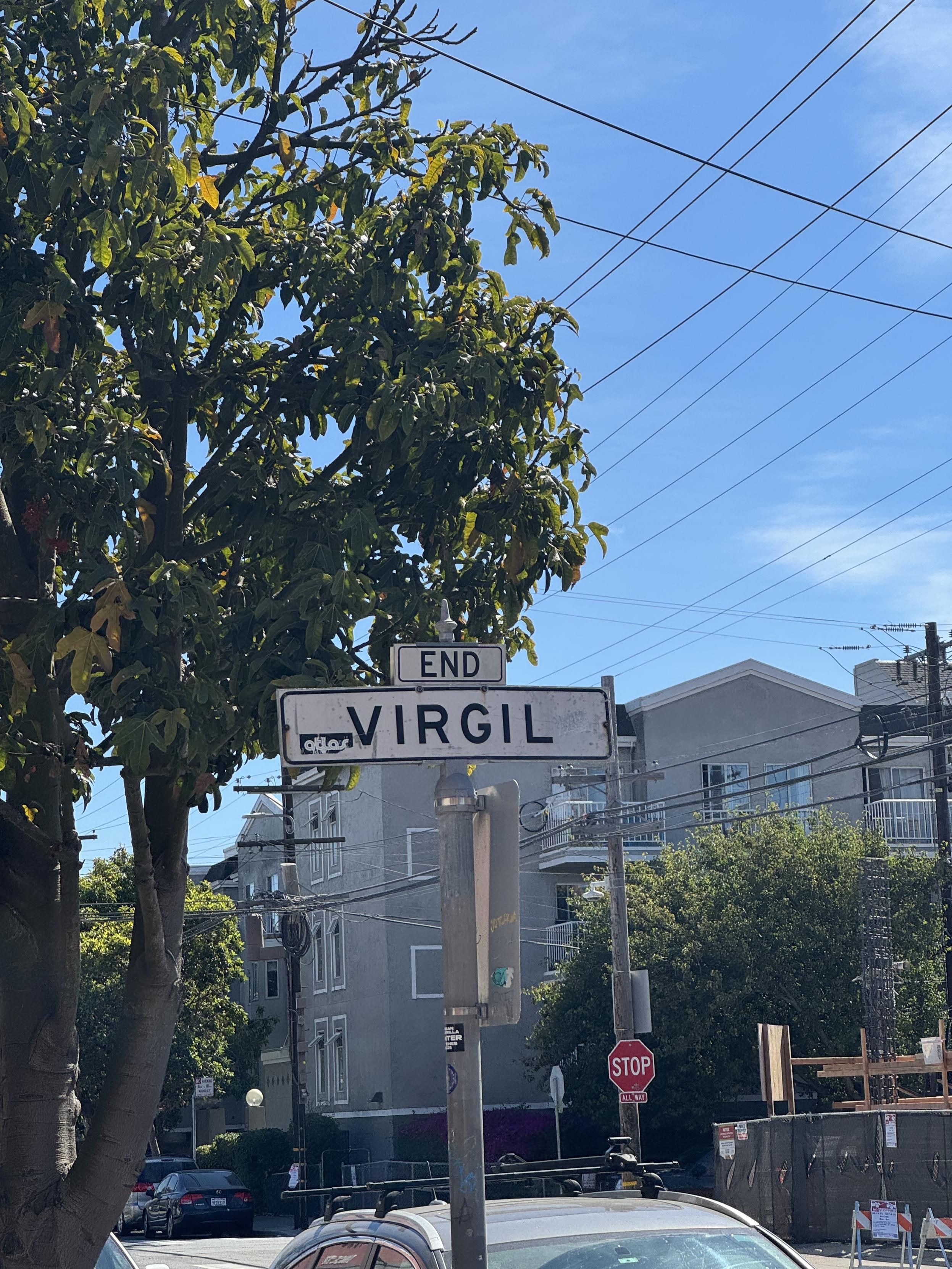
    a white street sign in sf marking the end of Virgil street, white with black letters  ENDVIRGIL
    Figure 1. a white street sign in sf marking the end of Virgil street, white with black letters ENDVIRGIL.
  6. Morning Walk

    Figure 1. A map of San Francisco, California. The path of a one and a half mile (two and a quarter kilometer) walk is indicated. About 2800 steps and 56 feet (17 meters) elevation over one and a half hours, (half an hour moving).
  7. Morning Walk

    Figure 1. A map of San Francisco, California. The path of a one and a half mile (two and a half kilometer) walk is indicated. About 3200 steps and 66 feet (20 meters) elevation over three quarters of an hour, (half an hour moving).
  8. Some of this was made easier by walking the weekend of SF Pride, so that I could walk alley to alley across the numbered streets near Market with impunity because the roads were all closed.

    I really want to walk the Portola but I’m gonna have to learn the bus transfers to even get there, so I’ll probably work through Hayes, the TL, FiDi, and North Beach first instead.

  9. 🚶🏽‍♂️

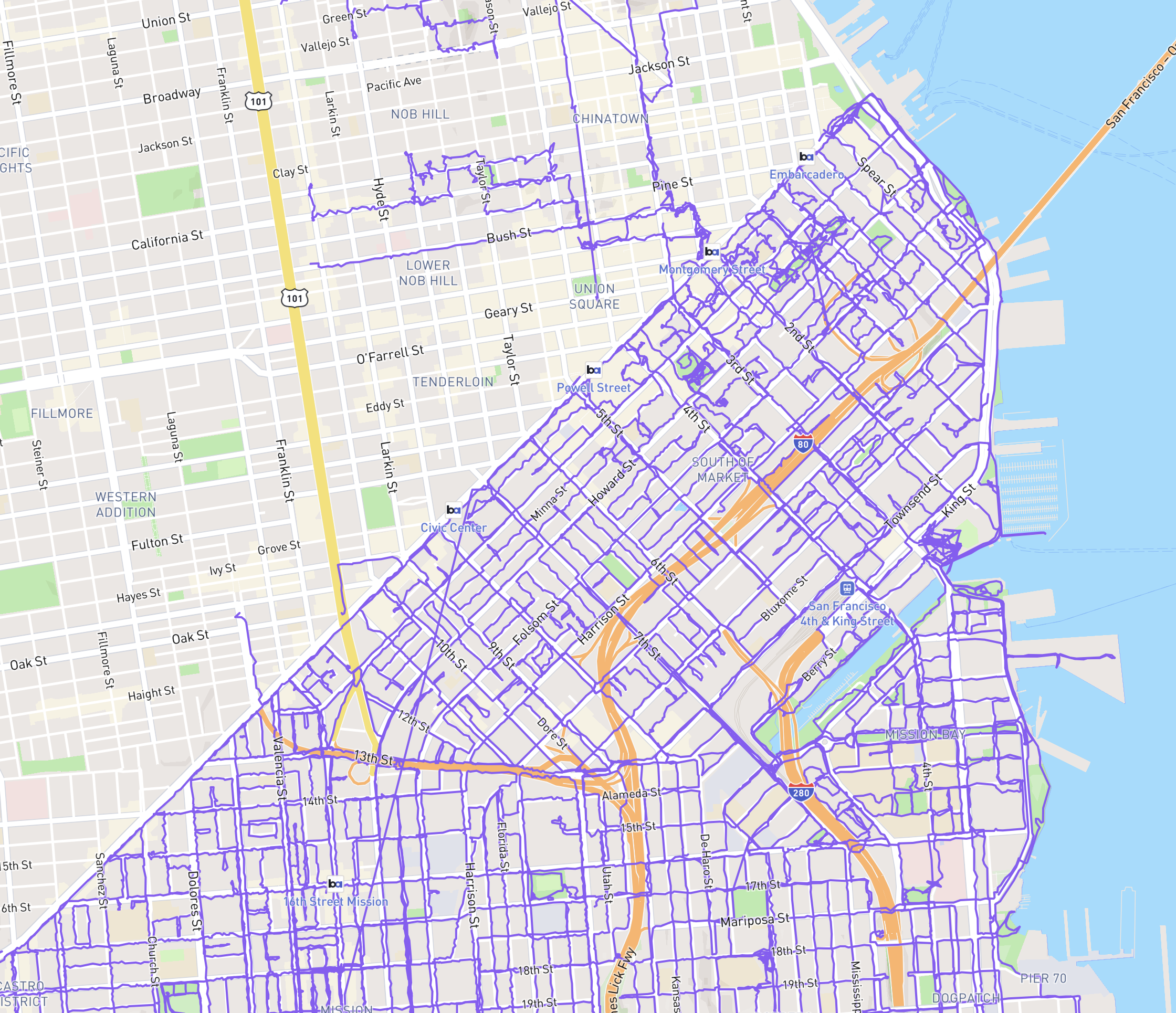
    🏁 what I’m considering SOMA, Rincon Hill, and South Beach loosely and not accurately bound by 16th Street, Market Street the Embarcadero, and Mission Creek.

    I don’t get to SOMA very often, and when I do it’s from Muni or a BART or whatever so it was mentally just a bunch of islands.

    Lots and lots of half-block alleys to dead ends, and in fact I left the dead ends of Welsh St. from Fifth and Morris unwalked. Oh well.

    Next: starting on the north side of market.

    https://mastodon.social/@gravely/114529945329729737

    a map of san francisco’s east side with the fefrry building in the top right corner and market at castro in the bottom left corner. Every street and alley south of market (the bottom right half of the map) has a purple line on it indicating that I’ve walked it with GPS on. A few paths are also marke on the other side - from my work to various events and up to coit tower, but not much.
    Figure 2. a map of san francisco’s east side with the fefrry building in the top right corner and market at castro in the bottom left corner. Every street and alley south of market (the bottom right half of the map) has a purple line on it indicating that I’ve walked it with GPS on. A few paths are also marke on the other side - from my work to various events and up to coit tower, but not much.
  10. Lunch Walk

    Figure 1. A map of San Francisco, California. The path of a three and a quarter mile (five kilometer) walk is indicated. About 6300 steps and 30 feet (nine meters) elevation over one hour, (three quarters of an hour moving).

Pizza Slow (high quality)

© 2026 gravely