1. Lunch Ride

    Figure 1. A map of San Francisco, California. The path of a three and a half mile (five and three quarters kilometer) ride is indicated. About 36 feet (11 meters) elevation over half an hour, (a quarter hour moving).
  2. Watching a waymo creep in a crosswalk on howard parallel to me like a human would, even with probably-misplaced confidence that it is doing to so to

    1. get a right on red, but for my walk

    2. not be blocked by peds crossing when the light changes

    3. drive more like a human so that the human drives behind it don’t lose their god damned minds that the person in front isn’t off the line on the green

    4. because it is probably ultimately more efficient overall for the system

    5. training

    and I’m like, sure, makes sense, whatever, but this was a chance to reject all of that nonsense and use a computer driver to force-daylight both crosswalks and get rid of right on red and we didn’t do it.

    damn.
  3. Morning Walk

    Figure 1. A map of San Francisco, California. The path of a four and a quarter mile (six and three quarters kilometer) walk is indicated. About 8400 steps and 52 feet (16 meters) elevation over one hour.
  4. Morning E-Bike Ride

    Figure 1. A map of San Francisco, California. The path of a one and a quarter mile (two kilometer) e-bike ride is indicated. About 69 feet (21 meters) elevation over two and a half hours, (a quarter hour moving).
  5. Afternoon Walk

    Figure 1. A map of San Francisco, California. The path of a one and a half mile (two and a half kilometer) walk is indicated. About 3200 steps and 56 feet (17 meters) elevation over two hours, (half an hour moving).
  6. Morning Walk

    Figure 1. A map of San Francisco, California. The path of a one and a half mile (two and a quarter kilometer) walk is indicated. About 2900 steps and 72 feet (22 meters) elevation over half an hour.
  7. I am a few classes into Hubert Dreyfus’s 2007 ”Man, God, and Society in Western Literature” Berkeley lectures ( https://archive.org/details/ucberkeley_webcast_itunesu_461120619).

    The Internet Archive’s advanced search can return RSS which podcast apps understand, but it seems like it it’s for subscribing to new collections, not for turning collections into podcasts.

    So I think this is the best I can do? https://archive.org/advancedsearch.php?q=identifier%33Aucberkeley_webcast_itunesu_461120619fl%5B%5D=identifier&sort%5B%5D=&sort%5B%5D=&sort%5B%5D=&rows=50&page=1&callback=callback&save=yes&output=rss

    Internet Archivearchive.org (opens in a new tab)

    So, I upgraded my pocketcasts subscription to a tier that supports hosting arbitrary files, downloaded all of the mp3s from the archive, uploaded them to pocketcasts on the web, found them on my phone (profile, files, sort by name) and off I go.

    A little tedious and so-close but not there with just advanced search.

    Alas.

  8. this statue is stupid

    Figure 1. A map of San Francisco, California. The path of a one and three quarters mile (two and three quarters kilometer) walk is indicated. About 3400 steps and 10 feet (three meters) elevation over half an hour.
  9. 🚶🏽‍♂️

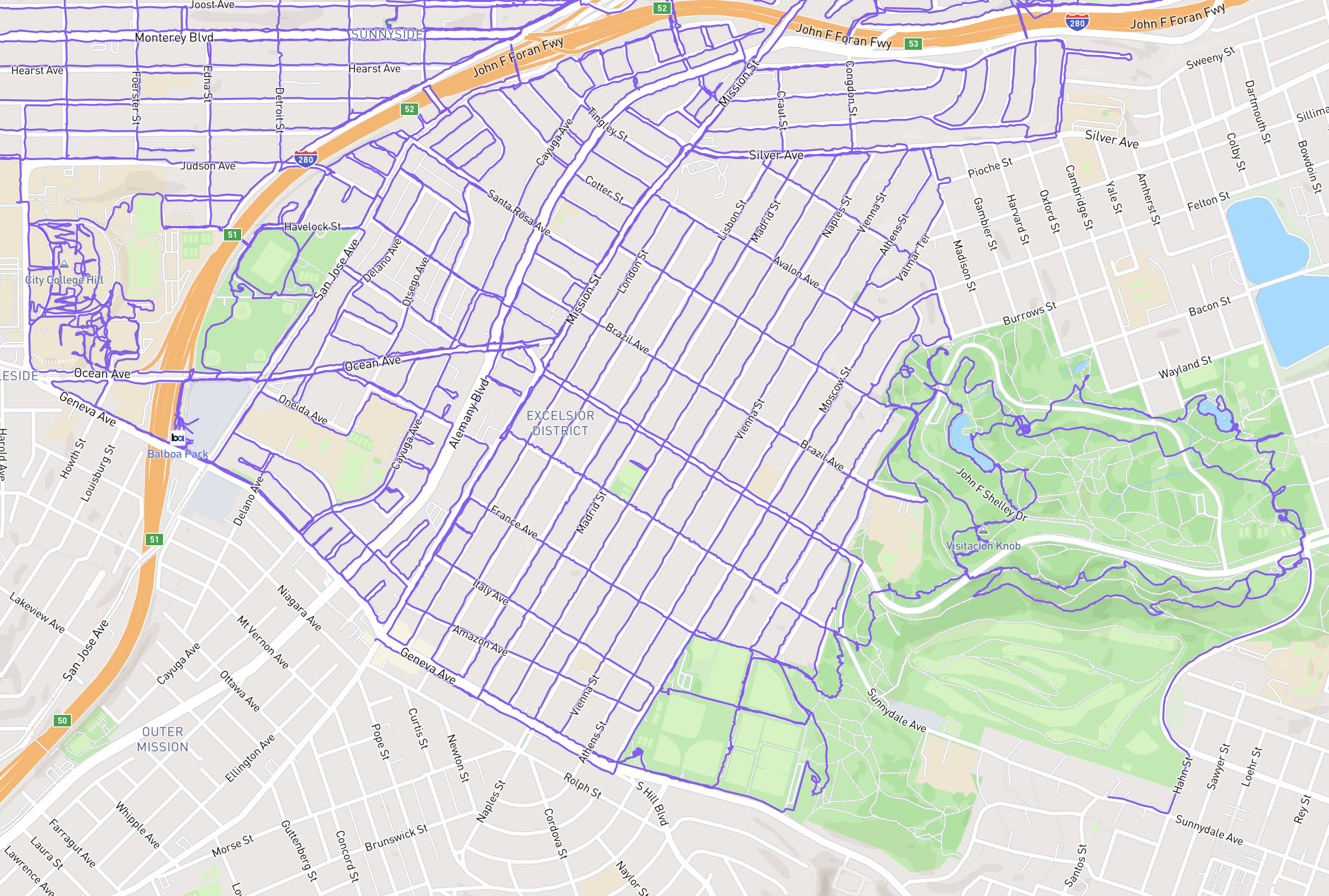
    🏁 what I’m considering The Excelsior.

    Lovely neighborhood of sidewalk gardens and views. Dipping into McLaren Park for the final few east side walks was a nice bonus. Getting there on the 14 or 49 or BART was convenient but the time it took limited how often I could get any miles in on weekday mornings. Luckily the buses stop a block from my house and are running by 6AM those mornings.

    Next: Outer Mission, or Portola?

    A map of San Francisco. Balboa Park BART along the center-left, McLaren Park in the bottom right quadrant, 280 running along the top, and the entirety of Excelsior’s streets (and not many alleys) marked with a purple trail.
    Figure 1. A map of San Francisco. Balboa Park BART along the center-left, McLaren Park in the bottom right quadrant, 280 running along the top, and the entirety of Excelsior’s streets (and not many alleys) marked with a purple trail.
  10. Morning Walk

    Figure 1. A map of San Francisco, California. The path of a five mile (eight kilometer) walk is indicated. About 9800 steps and 591 feet (180 meters) elevation over one and a half hours, (one and a quarter hours moving).

Pizza Slow (high quality)

© 2026 gravely