Figure 1. A map of San Francisco, California. The path of a five and three quarters mile (nine kilometer) walk is indicated. About 11300 steps and 715 feet (218 meters) elevation over one and three quarters hours, (one and a half hours moving).
Figure 1. A map of San Francisco, California. The path of a six and a quarter mile (10 kilometer) walk is indicated. About 12500 steps and 814 feet (248 meters) elevation over one and three quarters hours.
this thing is chock full of software upscaling a la “Let It Be”, and that’s certainly a choice. I know this pisses lots of people off (like normalization, autotune, drum machines, etc) and I’m not gonna tilt at it, it’s just a thing people are doing right now.
I think it’s ok to be mad at the dip in quality between film and digital and not want to present it in 320 lines of blur. I don’t think this is a “let people enjoy things” take.
23rd book of the year: “Zoey Is Too Drunk for This Dystopia" by Jason Pargin. Fun as expected. A pre-order, because that this point I just subscribe to Pargin stuff.
It’s been two months since I finished anything, my head has not been in the right space to read, I’d bounced off three other things, and I’ve been taking lots of long walks instead.
Figure 1. Hardback cover, dark purple circuit-looking lines over purple background, illustration of someone wearing a pink cat earring with orange flames obscuring their face and a butterfly obscuring the flames, holding a wine glass of flames, title in black over a pink blob.
Figure 1. A map of San Francisco, California. The path of a six and a quarter mile (10 kilometer) walk is indicated. About 12500 steps and 545 feet (166 meters) elevation over one and three quarters hours.
Figure 1. A map of San Francisco, California. The path of a one and three quarters mile (three kilometer) walk is indicated. About 3700 steps and 85 feet (26 meters) elevation over one and a quarter hours, (one hour moving).
Was looking for a set of configuration params for something incredibly tedious to look up from scratch yesterday
I was pretty sure I’d temporarily had it in an unsaved sublime text tab and stumbled into sublime not only supporting “command-shift-T” to restore closed tabs but that I could keep going, back years in fact. Yikes. Wasn’t there though.
Maybe iTerm? Sure enough: Session -> Open paste history, from three weeks ago.
Figure 1. A map of San Francisco, California. The path of a five mile (eight kilometer) walk is indicated. About 9800 steps and 449 feet (137 meters) elevation over one and a half hours.
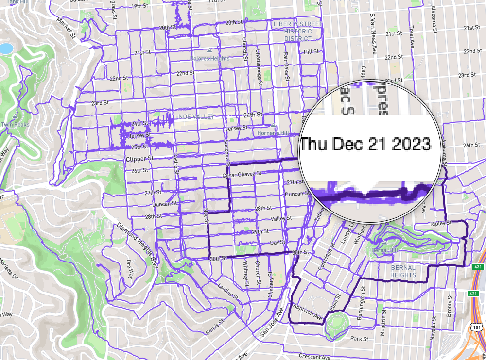
kindof a typical weekday: walk the kid to Flynn, continue on to try to hit blocks I’ve never logged walking, do about 5 miles, be back by 9-ish. But, today, I finally logged the last few blocks of Noe in the somewhat arbitrary bounds I established for myself to completion.
New bounds: from Caesar Chavez to 101 to 280 to San Jose Ave.
Figure 1. a street map of san francisco, from Twin Peaks to Dolores Park to 101, with purple lines demarking logged walks over 2/3 of the blocks. One walk is highlighted a darker purple looping around Bernal Heights, kissing Holly Park, and then west to Noe.