1. 👀👀👀

    Figure 1. A map of San Francisco, California. The path of a four and a half mile (seven and a quarter kilometer) walk is indicated. About 9100 steps and 164 feet (50 meters) elevation over one and a half hours, (one and a quarter hours moving).
  2. Morning Walk

    Figure 1. A map of San Francisco, California. The path of a four and a half mile (seven and a quarter kilometer) walk is indicated. About 8900 steps and 128 feet (39 meters) elevation over one and a quarter hours, (one hour moving).
  3. Morning Walk

    Figure 1. A map of San Francisco, California. The path of a four and a half mile (seven and a quarter kilometer) walk is indicated. About 9100 steps and 92 feet (28 meters) elevation over one and a quarter hours.
  4. tints

    Figure 1. A map of San Francisco, California. The path of a four and a quarter mile (seven kilometer) walk is indicated. About 8600 steps and 89 feet (27 meters) elevation over one and a quarter hours, (one hour moving).
  5. Lunch Walk

    Figure 1. A map of San Francisco, California. The path of a four and a half mile (seven and a quarter kilometer) walk is indicated. About 8900 steps and 95 feet (29 meters) elevation over three and three quarters hours, (one and a quarter hours moving).
  6. 🏁 what I’m considering bernal but which is a bit more I suppose? Bound by Ceasar Chavez, 101, Alemany, and 280, and which I’d already had a head start on.
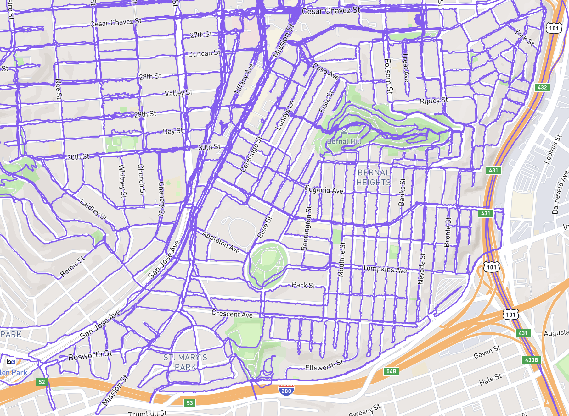
    A San Francisco street map centering the area bound by Ceasar Chavez, 101, Alemany, and 280, on which every street has a meandering purple GPS path I’ve logged on it.
    Figure 1. A San Francisco street map centering the area bound by Ceasar Chavez, 101, Alemany, and 280, on which every street has a meandering purple GPS path I’ve logged on it.
  7. this concludes my bernal tour, i've walked all of it

    Figure 1. A map of San Francisco, California. The path of a five and a half mile (eight and three quarters kilometer) walk is indicated. About 10900 steps and 751 feet (229 meters) elevation over one and three quarters hours, (one and a half hours moving).
  8. got so turned around i had to save the last walk to see what i had missed in city strides and then plot the way home

    Figure 1. A map of San Francisco, California. The path of a one mile (one and three quarters kilometer) walk is indicated. About 2200 steps and 59 feet (18 meters) elevation over a quarter hour.
  9. Afternoon Walk

    Figure 1. A map of San Francisco, California. The path of a four and a quarter mile (seven kilometer) walk is indicated. About 8700 steps and 807 feet (246 meters) elevation over one and a half hours, (one and a quarter hours moving).

Pizza Slow (high quality)

© 2026 gravely